


Description
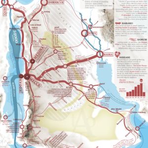
As for the historical contribution of the Nile river, it hardly needs any extensive introduction. But as i did my research for the 1860 Atlas, I found that this great river has five distinct personalities; The Good, The Bad, The Ugly, The Crossroad and The “Start”. These personalities have defined the areas around the river and the trade that was conducted along its banks.
Read more about Navigating the Nile here.
MAKING THE MAP
The map is compiled from old travel accounts, contemporary official reports and modern research.
The map is fully original and hand-made by myself.
THE PRINT
Width: 197 mm (7,8″)
Height: 684 mm (26,9″)
Margins: 7 mm (0,27″). Allows for framing without losing information.
Suitable for gluing onto a foam board.
The map is printed on high quality thick paper from a local printer in Leuven, Belgium.
SOURCES
Alfred Henri Dye (1899) Le Bahr al Ghazal
Hermann Habenicht (1885) Spezial-karte von Africa
Alvan S. Southworth (1884) The Soudan and the valley of the White nile
Chas P. Stone (1884) The navigation of the Nile
Richard Burton (1860) The lakes regions of central Africa




Reviews
There are no reviews yet.