
Description
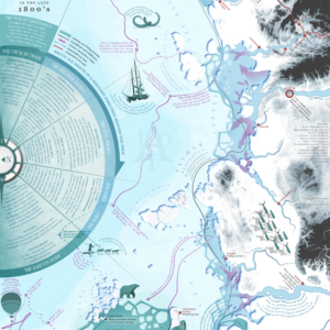
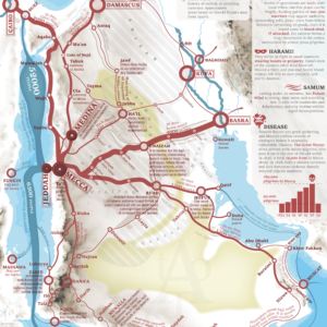
A map showing the coffee regions of the world and where the best coffee can be found. It also depicts the approximate trade volumes from each region to America and Europe. The map depicts information on drinking habits of different parts of the world as well the different coffee types cultivated and who fancied what kind of coffee. The late 1800’s was a pivotal point in the history of Coffee, a time of experimentation and the start of true globalization.
Read more about World Coffee Trade here.
MAKING THE MAP
The map is compiled from old travel accounts, contemporary official reports and modern research.
The map is fully original and hand-made by myself.
THE PRINT
Width: 500 mm (19,69″)
Height: 400 mm (15,75″)
Margins: 7 mm (0,27″). Allows for framing without losing information.
Suitable for framing or gluing onto a foam board.
Perfect for affordable 400×500 mm frames, such as from IKEA, as seen in the photos.
The map is printed on high quality thick paper from a local printer in Leuven, Belgium.
SOURCES
John Bartholomew (1907) Atlas of the World’s commerce
Francis B. Thurber (1881) Coffee from Plantation to Cup
Robert Hewitt Jr. (1872) The Coffee, Its History, Cultivation and Uses
P.L. Simmonds (1864) Coffee and Chicory


Reviews
There are no reviews yet.